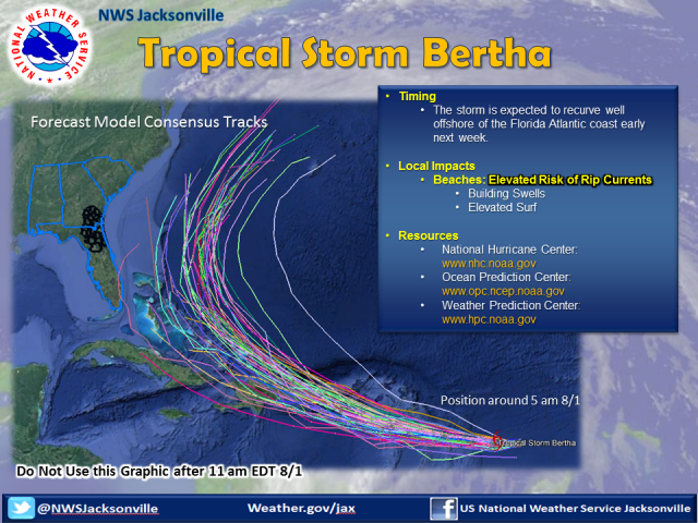
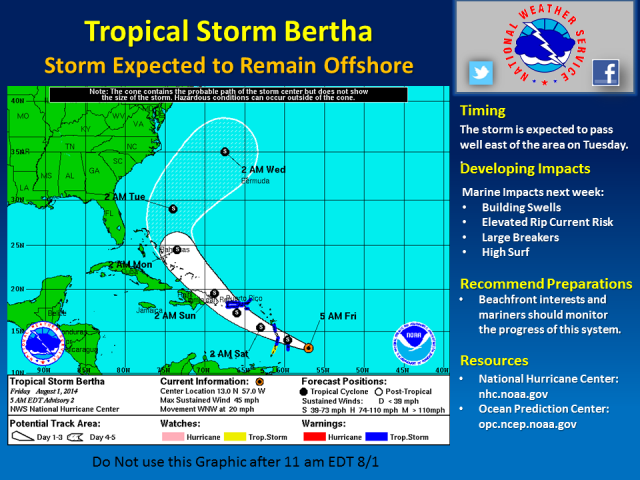
As we head into the weekend, we wanted to reinforce that newly formed Tropical Storm Bertha is expected to remain offshore of the U.S. southeast coast this weekend through next week. There is high confidence in this forecast track, as evidence by the forecast model suite in the below graphic:
Local Impacts:
Surf Zone: Increasing rip current risk is expected Monday through Wednesday. Also, swells and breakers heights may also increase next week.
Marine: Elevated seas due to building swells likely next week. At this time, offshore wave heights of 4-6 ft are possible Tue-Wed.
NWS Jacksonville Contact Numbers: (800) 499-1594, ext. 1 & (904) 741-4370, ext. 4
NWS Jacksonville Webpage: srh.noaa.gov/jax
NWS Jacksoville Facebook: www.facebook.com/NWSJacksonville
NWS Jacksonville Twitter: twitter.com/NWSJacksonville
Sign up for Weather Alerts: inws.wrh.noaa.gov/
AHPS River Forecasts: water.weather.gov/ahps2/index.php?wfo=jax


